Interactive Trailhead Map
3D Terrain • Topographic Contours • SatelliteElevation Gradient Profile
GPX TelemetryTrailhead Parking & Access Directions
Trail Description
Eaton Lake is a challenging 9.3-kilometre out-and-back trail located just outside Hope, British Columbia, demanding a relentless vertical climb of +1315 metres from a starting elevation of 422 metres to a high point of 1347 metres. The route immediately tests lower-leg endurance with a steep, continuous series of rigorous switchbacks ascending through a dense Pacific Northwest forest canopy dominated by towering Douglas fir, western hemlock, and mature cedar. Hikers navigating this punishing ascent will encounter a rugged trail tread characterized by packed forest soil, steep rock stairs, exposed root systems, and occasional sections of slick granite, making surefootedness and sturdy footwear essential for the duration of the climb.
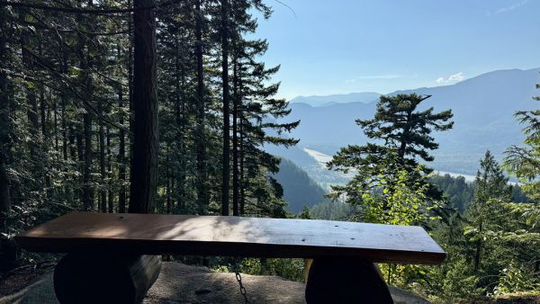
As the path pushes out of the lower timberline and into the subalpine transition zone, the landscape opens up to reveal stunning natural features, including cascading mountain creeks, rushing waterfalls, and rugged canyon walls flanking the valley below. The upper stretches of the route deliver sweeping vistas of the surrounding rugged peaks and dramatic ridgelines before terminating at the pristine shoreline of Eaton Lake, a dramatic alpine basin hemmed in by steep mountain slopes. This rewarding backcountry water body serves as an exceptional vantage point for bird watching, wildlife spotting, and taking in the raw, undisturbed topography of the remote BC interior.
To reach the trailhead, motorists drive south down the Skagit Valley towards Ross Lake, utilizing the designated parking area situated at coordinates 49.2475228, -121.3918362 to access the staging zone. The approach roads to this drainage are typically manageable for standard passenger vehicles, though motorists should exercise caution regarding seasonal maintenance and watch for potholes or gravel washouts along rural forestry roads. The optimal seasonal window for tackling the Eaton Lake trail runs from late July through October, once the winter snowpack has sufficiently melted and exposed the upper alpine terrain to safe, snow-free hiking conditions.
Trail Features & Highlights
(7)Suitable Activities
(3)Trail Safety & Planning
Offline GPS Navigation
100% FreeNo cell signal at trailhead? Download your offline GPS track or print a pocket sheet before heading out. Zero subscriptions or paywalls.
Dog Regulations
Dogs are welcome but must be kept on a leash at all times. Pack out all pet waste to preserve BC wilderness trails.
BC Wilderness Safety
SAR is 100% Free- Always carry bear spray on your person
- Pack the 10 outdoor essentials
- File a trip plan with AdventureSmart BC →

Report a Problem with this Trail
Eaton Lake
🚩 Flag Community Review
How to Use Offline GPX Navigation
100% Free • No Subscription Paywalls
Most BC trailheads lose cellular reception kilometers before the parking lot. Follow these 3 simple steps to navigate safely offline using your phone or GPS watch:
Download the Official Track
Click Download GPX to save the
.gpx track file to your device.
Open in Any Hiking App
Tap the downloaded file and choose "Open With" or use the "Import GPX" feature in your favorite app:
Track Real-Time Location Offline
Your phone's built-in GPS antenna operates independent of cellular towers. You will see your exact location relative to the route even in airplane mode.
Backcountry Safety Tip: Download the offline base map of the region at home over Wi-Fi before heading out, and consider carrying a physical topographic map and compass as a backup.
No trails found for ""
Try searching for a mountain peak, provincial park, or nearby town.
Personal Hiker Stats
Used for custom Heart Rate Zones, Hydration, and Calorie calculations